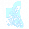
| Census Districts (CD), 1871 Census of Canada |
Department of Geography, University of Guelph |
1990 - 1995 |

|
| Roads (RDS) |
DMTI Spatial Inc. |
2003 - 2005 |
|
| Minor Water Points (MNWTP) |
DMTI Spatial Inc. |
2003 - 2014 |

|
| Major Water Regions (MJWTR) |
DMTI Spatial Inc. |
2003 - 2014 |

|
| Minor Water Regions (MNWTR) |
DMTI Spatial Inc. |
2003 - 2014 |

|
| Enhanced Points of Interest (EPOI) |
DMTI Spatial Inc. |
2001 - 2015 |
|
| Major Name Points (MJNMP) |
DMTI Spatial Inc. |
2003 - 2014 |

|
| Minor Name Points (MNNMP) |
DMTI Spatial Inc. |
2003 - 2014 |

|
| Minor Water Lines (MNWTL) |
DMTI Spatial Inc. |
2003 - 2014 |

|
| Intermittent Water (MNINR) |
DMTI Spatial Inc. |
2005 - 2014 |

|
| Major Road Casements (MRC) |
DMTI Spatial Inc. |
2001 - 2014 |

|
| Regional Municipality Boundaries (RMN) |
DMTI Spatial Inc. |
2001 - 2014 |

|
| Major Water Points (MJWTP) |
DMTI Spatial Inc. |
2003 - 2014 |

|
| Turn Restrictions Table (trn) |
DMTI Spatial Inc. |
2001 - 2014 |
|
| Greater Toronto and Hamilton Area (GTHA) Boundary |
DMTI Spatial Inc. |
2002 - 2012 |
|
| Pipelines and Transmission - Points (PTP) |
DMTI Spatial Inc. |
2001 - 2014 |

|
| Parks and Recreation - Regions (PRR) |
DMTI Spatial Inc. |
2001 - 2014 |

|
| National Water (WAT) |
DMTI Spatial Inc. |
2001 - 2014 |

|
| Physiography - Lines (PHL) |
DMTI Spatial Inc. |
2001 - 2014 |

|
| Routes Look Up Table (rte_lut) |
DMTI Spatial Inc. |
2001 - 2014 |
|


